Link Profile Adjustment Examples
These examples show how Cambium link planners use a map, Google Earth and surveys to adjust link profiles.
The original path profile for the point-to-point link from Addislade Farm to Yelland Cross Farm is built using the Path Profiler data where the clutter along the path is all set to Rural with 0 m height:
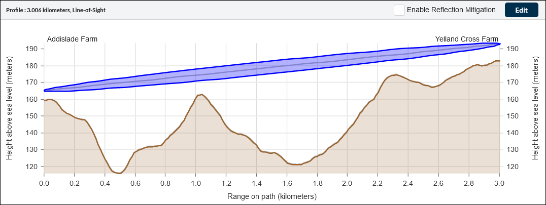
Original path profile
We verify the link ends and the high points as described in the following examples:
These methods are applied to both link ends and to all high points in the link path. The resulting path profile is shown here:
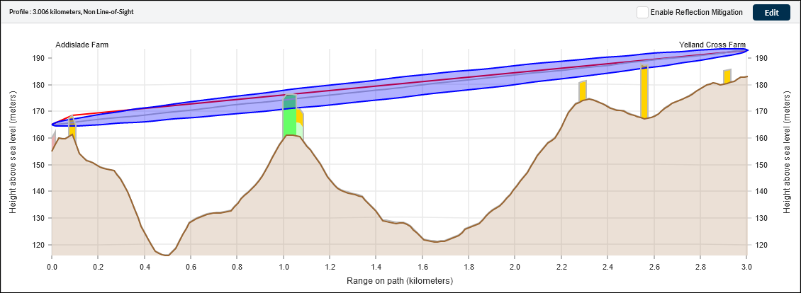
Adjusted path profile